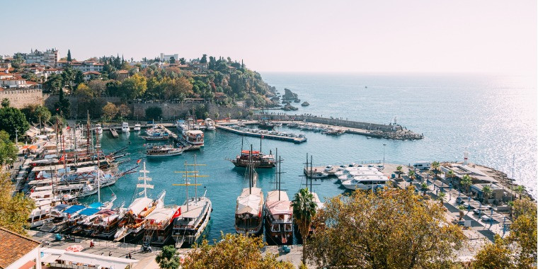
Transfers
Aydıncık
Aydıncık is a district of Mersin Province.
History
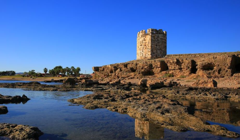
The historical name of Aydıncık, which has been the cradle of various civilizations, is Kelenderis. According to mythology, Kelenderis was founded as a port and trade city three thousand years ago by Sandakos, one of the Phoenicians who had advanced in maritime and trade. The city was later dominated by the Hittites, Assyrians, Samos, Seleucids, Egyptians, Romans, Byzantines, Umayyads, Armenians, Karamanids and Ottomans.
Kelenderis had its first heyday in the 5th and 4th centuries BC. Its own money began to appear in the 5th century BC and lasted until the arrival of Alexander the Great in Anatolia. A silver Kelenderis coin dated 425-400 BC has a horseman sitting sideways on a rearing horse on the obverse, and a kneeling goat on the reverse side.
As the Romans dominated the region, the Kelenderis Port was used considerably and this became an indispensable commercial city of Rome. The city was reconstructed during the Romans, and it was a perfect city with its castle, palace, waterways, baths and harbor.
The city, which was also built during the Byzantine period, became one of the most beautiful and civilized regions of its age. The region passed into the hands of the Armenians in the 11th century. In 1228, Ertokuş Bey, one of the commanders of Karamanoğlu Alaeddin Bey, took Kelenderis Castle from the Armenians and settled the Turks who came here from the east. Our region was named Gülnar because the Oghuz tribes affiliated to Gülnar Hatun migrated from the city of Merv in the Khorasan Region and settled in the Taurus Mountains. In 1461, together with Silifke and Mut, Gülnar joined the Ottoman administration by Gedik Ahmet Pasha during the reign of Fatih Sultan Mehmet.
The name Kelenderis changed over time and turned into Gilindire, while saying Kalendria, Kelendri, Gelendir, Gilindir. The Greeks in the district went to Greece via Cyprus by getting on boats from the pier due to the population exchange. It is said that in the 1920s, about 500 Greeks were engaged in crafts in Gilindire, and after the migration, very little population remained in the center of Gilindire.
In accordance with the new administrative division brought by the 1867 Provincial Regulation, the counties of the İçel Sanjak were: Anamur, Mut, Silifke and Gülnar, whose center was Kilindria.
The population increased towards the end of the 1970s. In 1965, the name Gilindire disappeared into history. The new name of the town is now Aydıncık. Iskele Municipality was established in Aydıncık, a sub-district of Gülnar District, in 1972.
Aydıncık became a district on 19 June 1987 according to Law No. 392. In addition, with this law, the name of İskele Municipality was changed to Aydıncık Municipality.
Today's Aydıncık is the continuation of Gilindire, which was once the center of Gülnar district.
Geography
Geolocation:
Aydıncık is located in the Mediterranean Region, on the slope of the nearest branch of the Taurus Mountains along the Mediterranean coast. It is a growing town. There is Gülnar in the east of the district, current Silifke, Bozyazı district in the region, and the Mediterranean Sea in the south.
Superficial:
Aydıncık center was established on the seaside, partly on the plain and partly on the slope of the mountain, which stretches along the coast. Yenikaş and Hacıbahattin villages of Aydıncık are on the sea border, but Karadere, Karaseki, Teknecik, Yeniyürük, Yeniyürükkaş, Eskiyürük, Pembecik and Duruhan villages are on the plateaus of the Taurus Mountains.
The coastal length of Aydıncık is 38 km. and it should be celebrated relatively indented, although not as much as the Aegean coast. It is seen that a branch of the mountain range forming the Taurus Mountains, which extends from Taşmasa, a hill dominating the district, towards the Mediterranean to the south of the district center and parallel to the coast where the district center comes from, extends towards the Mediterranean and forms the Sancak Point. From Taşmasa to the west of Sancak Point, the Büyükalan, Küçükalan, Gilindire and Soğuksu coves, formed by the intrusion of the sea, can be seen. Moreover; Between Sancak Point and Büyükalan, it is seen that there are 4 islets, including Yelkenliada, which is almost around the land, Küçükada, which grows 250 m from the land, Büyükada a little further (about 1 km from the shore), and Yılanlıada (which is carried out about 3 km from the shore) at the far end. There are areas declared as 1st degree protected area located and separated in this region with Sancak Point. The region between Gemidurağı, where the Sancak Cape comes from, and Yelkenliada, contains caves, which are the habitat of the Mediterranean monk seal. In addition, 20 pairs of island gulls (Larus audouini), of which 40 pairs in total, are located in Yelkenliada and Küçükada in the Eastern Mediterranean. Yılanlıada is the farthest of the four islands in Aydıncık. METU Underwater Society, Shipwreck Research Group (METU-SAT BAG) and Underwater Research Association, Underwater Archeology Research Group (SAD SAAG) made many dives around Yılanlıada in 2002. In this area they discovered a sunken area with anchors of various types and shapes. For this reason, Yılanlıada is a first degree protected area.
Aydıncık central district, which was established on a thin and long 9 km coastline, has five neighborhoods from east to west, namely Yenimahalle, Hürriyet, Cumhuriyet, Merkez and Atatürk.
Climate and Vegetation:
In the coastal areas of Aydıncık, the climate is mild, but in the upper plateau areas, it is not as harsh as the continental climate prevailing in the Inner Andolu Region, but it gets harsher compared to the coastal areas. Vegetation In the coastal areas of Aydıncık, laurel, carob, blueberry, puree, wild olive, holly oak etc. maquis trees are covered with pine, acorn, juniper, hawthorn, cypress trees in the upper plateau sections.