
Sapanca
Sapanca is a town located on the western border of the province of Sakarya. Its population is 44,712 as of 2022.
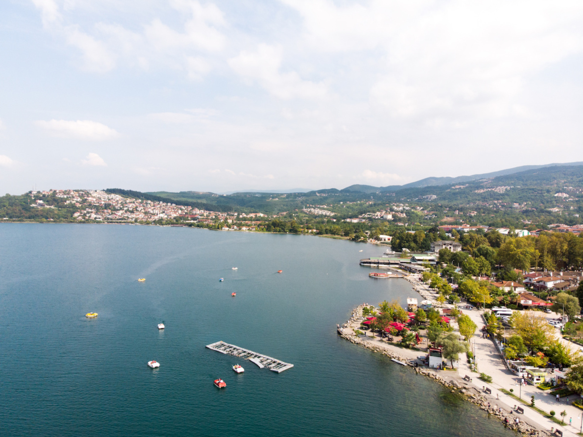
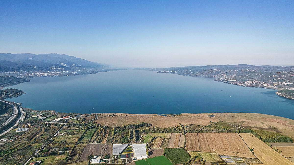
According to the known written documents, Sapanca, which was mentioned as a settlement with the arrival of the Phrygians in the region in 1200 BC, was in real terms A.D. It was founded in 378 by the Bithynia Kingdom. The name Siphonensis Lacus was used for the first time in a Laz source from 391. During the Eastern Roman Empire, it was called Buanes, Sofhan and Sofhange. With the arrival of the Anatolian Seljuks in Sapanca and its surroundings in 1075, the region began to be called Ayan and Ayanköy. After the Crusades, the region passed to the Byzantines again. Evliya Çelebi, who passed by the town on his way to Erzurum in 1640, gives the following information about the town: "Once an old man from Izmit cleared the forest and bushes here and plowed, a village called Sabancı Koca was established. Then, as time passed, it became a flourishing town and became a town during the reign of Suleiman the Magnificent. In the town, Sarı Rüstem Pasha built an inn with 170 hearths. It has a beautiful mosque, bath and bazaar. Its soup kitchens are covered with lead sky. There are about 1000 houses covered with tiles. All of the soup kitchens are built by Mimar Sinan. Another work of Mimar Sinan is the Pertev Pasha inn. Most of this charitable work is It is managed by the trustee of the foundation because it is owned by Rüstem Pasha. There is a janissary Serdar here. It is famous for its white cherry. There is a baker's shop at the bottom of its bath. With the blessing of a dervish, he bakes a kind of white and unique bread loaf, which is called sabanca loaf. Even if it stays forty, it is not likely to dry out and lose its flavor. It is so famous that they took one of them to the Persian shah with a fresh grit, and he liked it too. Some say that it is in the water to make such delicious and unique bread. In 1837, during the reign of Mahmut II, Adapazarı was turned into a district center. Sapanca is connected here as a township. The Izmit - Bolu road was passing through Sapanca. In his book Cihannüma, Kâtip Çelebi records about the Sapanca section of this road that the road passes through water for half a mile here and rises to the stirrup when the waters are high. The same recipe was made by Charles Texir in the first half of the 19th century. You can go on the sands of the lake for about an hour. In some places the waters go up to the columns. The railway, which came to Sapanca in 1890, was passed by opening the narrow shore mentioned above. After the construction of the railway, the highway was neglected and became almost impassable. After the 93 War, Laz population came to many neighborhoods of the district. In the Republican era, the highway was not passed over the narrow shore of the lake, but behind the slopes. Thus, the town continued to fulfill its historical transport route, both by rail and road. Although Sapanca seemed to lose its importance for a while with the passing of the E5 Highway across the lake in the 1950s, it regained its historical mission with the passing of the TEM Highway in 1989. Sapanca was separated from the central district as a subdivision in 1957 and became a separate district. Sapanca is a district of Sakarya province. Sapanca Lake in the north, Arifiye in the east, Samanlı Mountains, Geyve and Pamukova districts in the south, and Kocaeli central district Izmit in the west. Its area is 119 km² and its height from the sea is 36 m. It is the district of Sakarya with the smallest surface area and the highest population density.
Its climate is transitional between the Mediterranean climate and the Black Sea climate. Heavy rains in winter are usually in the form of rain. The season with the most precipitation is winter, and the least precipitation is summer. Summers are hot and dry, relative humidity is high. The hottest month is July with 22.8 °C and the coldest month is January with 5.5 °C. The annual average temperature is 14.3 °C. In addition, the lowest temperature measured instantaneously is -11.2 °C and the highest temperature is 40.2 °C.
District lands are divided into two parts in terms of landforms. The first part includes the northern slopes of the Samanlı Mountains, the extension of the Köroğlu Mountains extending from the south of Bolu, and the valleys formed on these slopes. This section is quite bumpy. The second part is the foothill plain, on the northern skirts of the Samanlı Mountains, where the Sapanca district center is located. This plain was formed by the alluviums carried by the streams descending from the northern slopes of the mountains. The most important creeks descending from these mountains are Istanbul Stream, Kurtköy Stream and Mahmudiye Stream. In addition, Akçay Stream, which is the most important stream of the district, joins with the Sakarya River. The North Anatolian Fault Line passes through Sapanca Lake. For this reason, the district is a first degree earthquake zone. However, the fact that the fault line passes through the lake has made the district center and other residential areas less affected by the earthquake. For this reason, the district survived the 17 August 1999 earthquake with little damage.