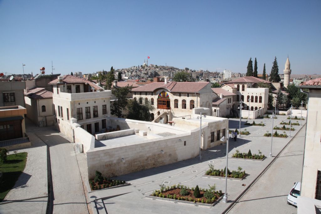
Transfers
Zerzevan Castle and Temple of Mithras
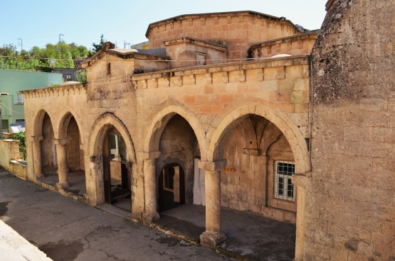
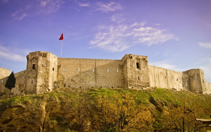
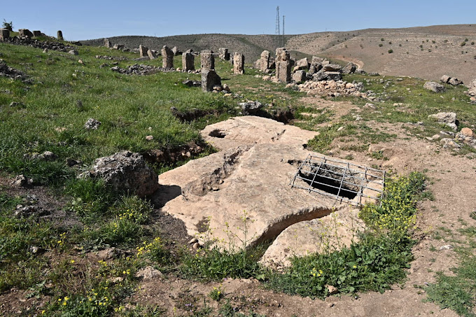
Zerzevan Castle is a historical building and military settlement located within the borders of Demirölçek neighborhood of Çınar district, between Diyarbakır and Mardin.
It was used as a border garrison during the Roman Empire. Considered one of the most important Eastern Roman monuments in Diyarbakır, the castle was included in the World Heritage Tentative List in 2020.
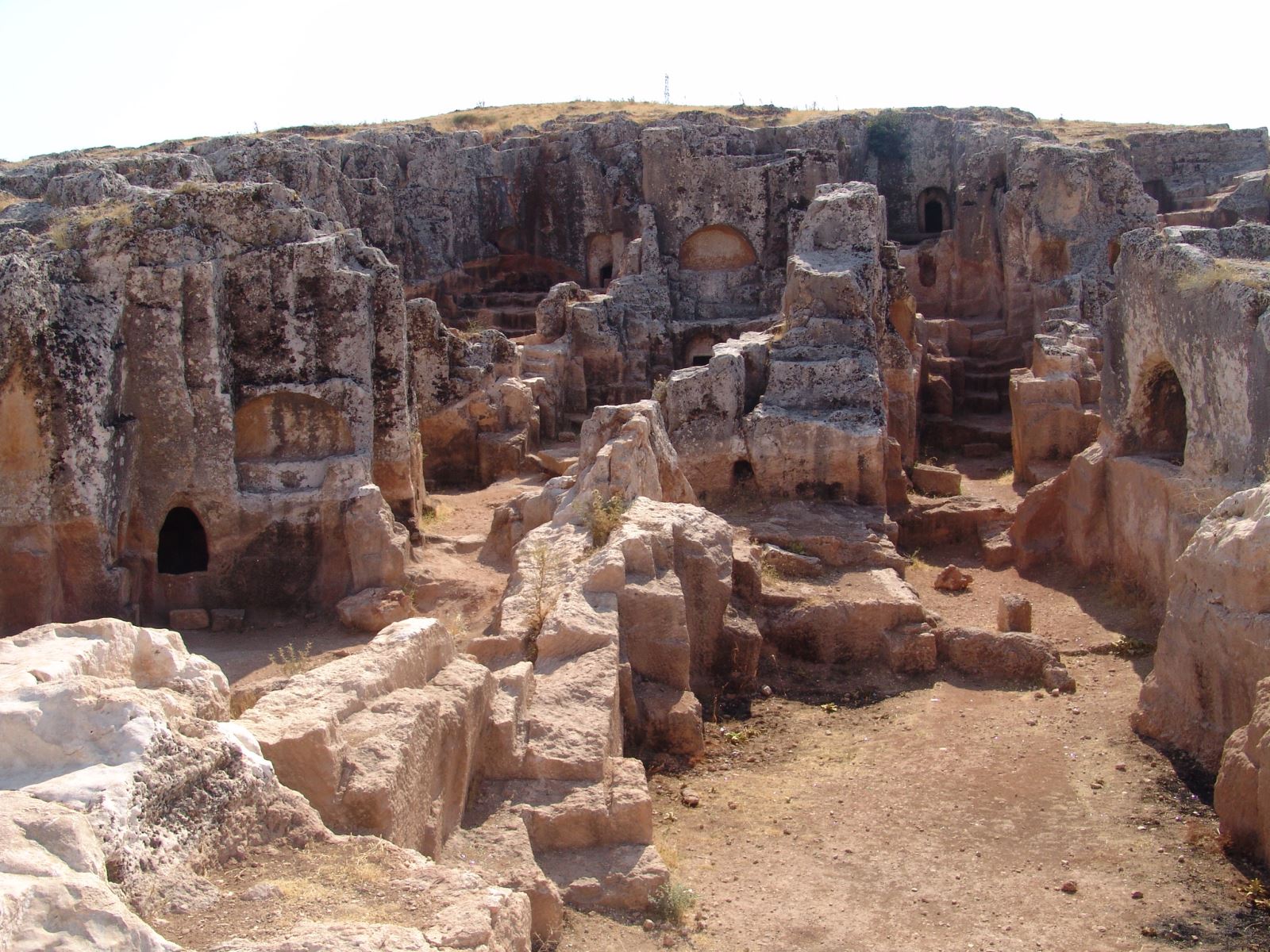
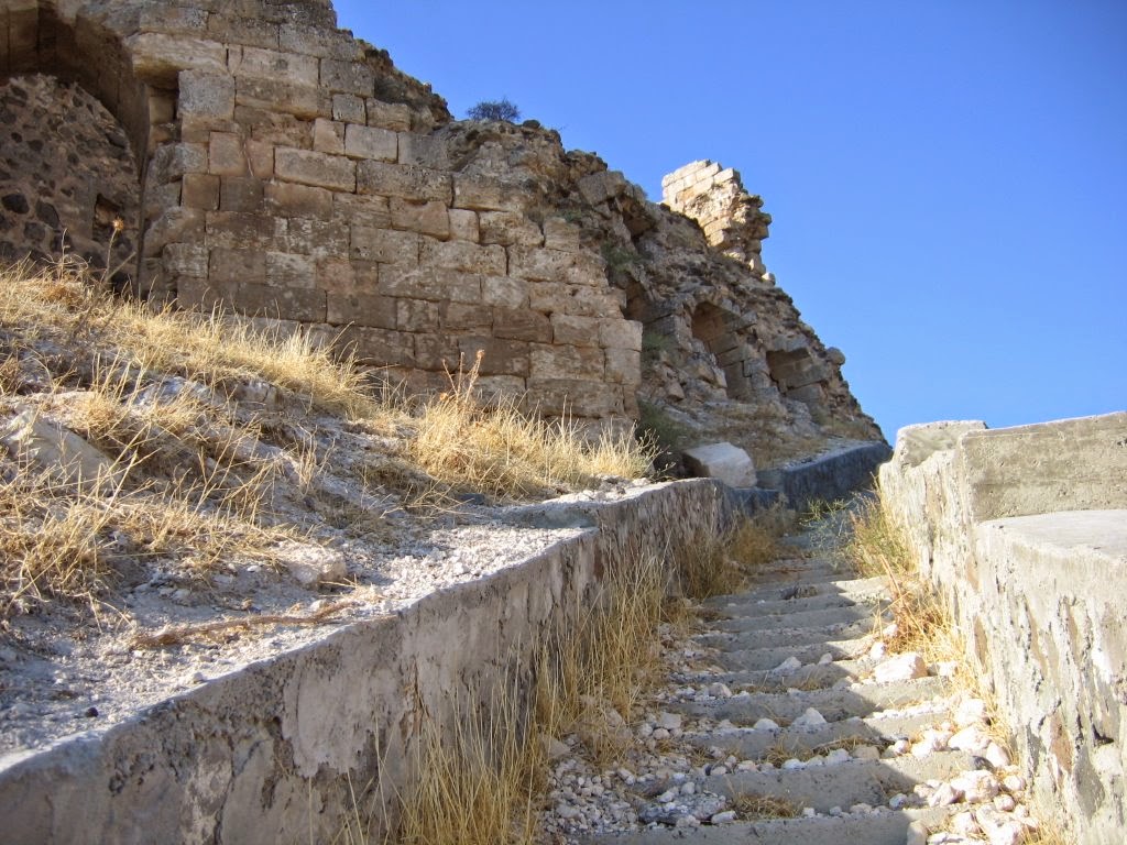
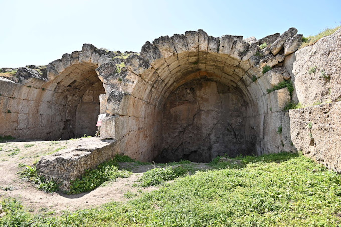
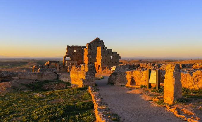
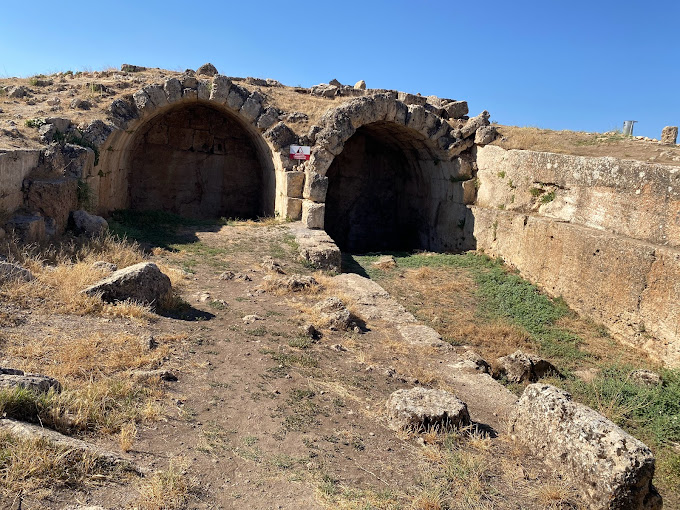
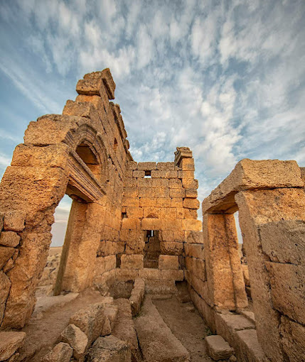
It is located on a rocky hill 124 meters above the road, at the forty-fifth kilometer of the Diyarbakır-Mardin highway. As a result of the excavations in the castle, which started in 2014, the remains of a 12-meter-high, 1.200-meter-long city wall, a 22-meter-high watchtower, a church, palace, residence, rock tombs, baths, grain and weapon warehouses, and 54 water cisterns were unearthed. It has become a place of ruin. Mitras Temple, located in Diyarbakır in 2017, is the most interesting structure of the castle today.
Although the period when it was first built is not certain, it is suggested that there was a castle called Kinabu in Zerzevan during the Assyrian period. It is thought that this castle was also used in the Persian period. The ancient name of Zerzevan Castle is probably Samachi.
Existing architectural remains and finds uncovered during excavations indicate that the area was dated to M.S. It was used in the 3rd century; It shows that it maintained its importance until the arrival of Islamic armies in 639 BC. The walls and structures of the settlement were probably repaired during the reigns of Anastasios I and Justinian I, and some structures were rebuilt to their current state.
It is thought that the settlement in the castle was not only a place where soldiers stayed, but also a place where civilians lived, as it was a place where people who settled in the water-rich valley and engaged in agriculture would take shelter. As a strategic Roman border garrison on the ancient trade route, dominating the whole valley, it witnessed many Roman-Sassanid struggles. After the conquest by the Islamic armies, the area where Zerzevan was located lost its geopolitical importance; Until the 1890s, the area was not used except for temporary shelters.
A family settled in the castle in the 1890s; For reasons such as water shortage and transportation difficulties, in 1967, as a community of 30 households, they went down from the castle and established a new village (today's name Demirölçek) with the name of Zerzevan Village, one kilometer away. The name Zerzevan is derived from the Kurdish word for gold, and the settlement must have been given while the village was here.
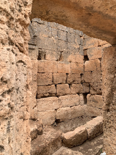
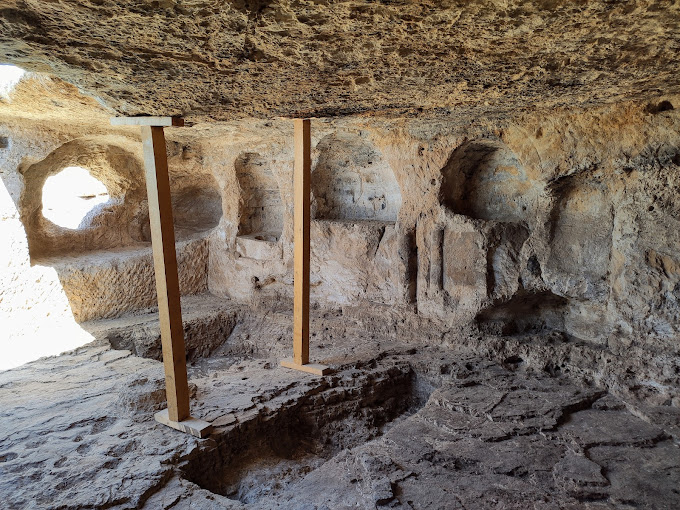
Excavations in the castle first started in 2014 with the permission of the Ministry of Culture and Tourism, General Directorate of Cultural Heritage and Museums. Structures such as the watch-defense tower, walls, Mithraeum, underground shelter, church, military-civilian residences, underground sanctuary, altars, rock tombs, water channels, which were unearthed in the excavations in the unknown settlement before the excavations, aroused national and international interest and became a ruin visited by tourists. It has become the place.
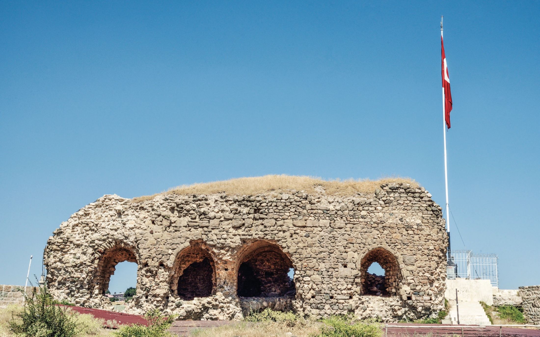
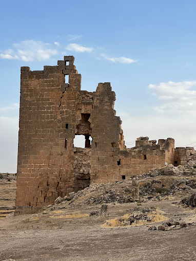
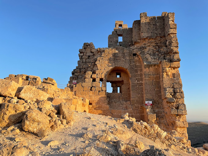
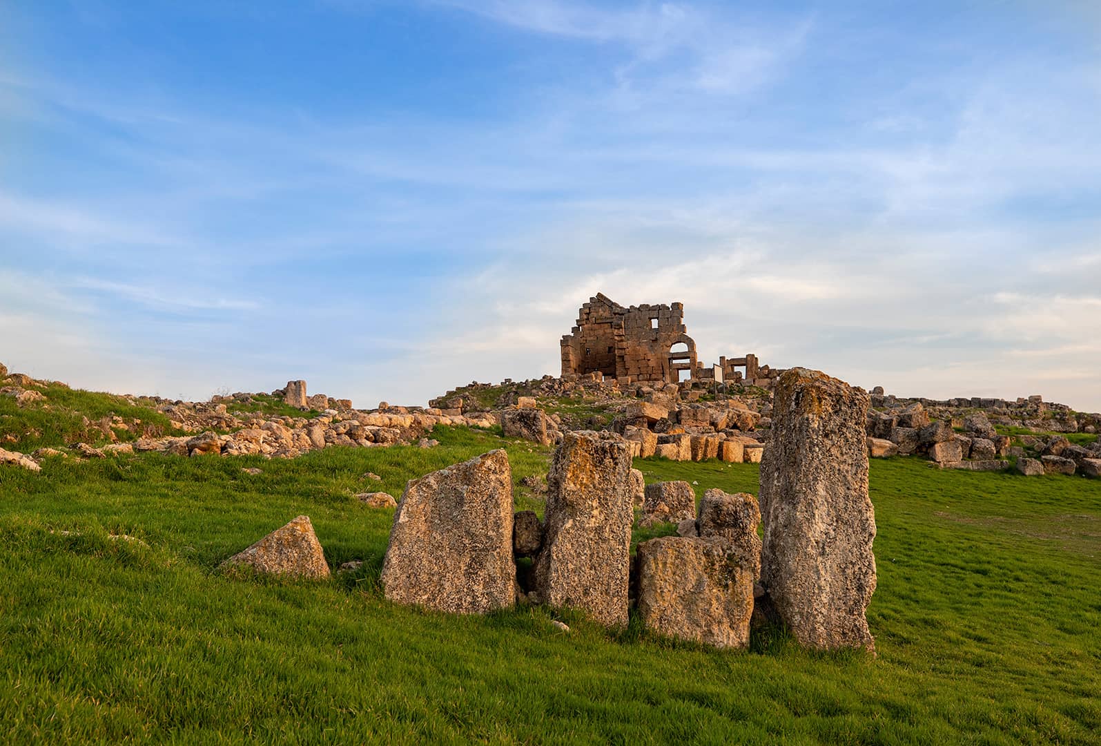
To the south of the military settlement built for defense, there are the remains of public works (watch and defense tower, church, administration building, arsenal, rock altar); In the north, traces of avenues, streets and residences can be seen. In the area where the residences are located, there are water cisterns, an underground sanctuary, an underground shelter and some structures whose function is unknown.
Settlement, 12–15 m. in height, 2.1 - 3.2 m. surrounded by thick walls. 1.2 km. There are 10 bastions and 2 towers placed at regular intervals on the long fortification wall. Up to 19.2 m of the large three-storey tower in the south of the settlement has been preserved, and its original height is 21 m. has been found to be.
Outside the walls, there are water channels, offering bowls, stone quarries and a necropolis.